Next Section | Table of Contents
doi:10.2204/iodp.pr.305.2005
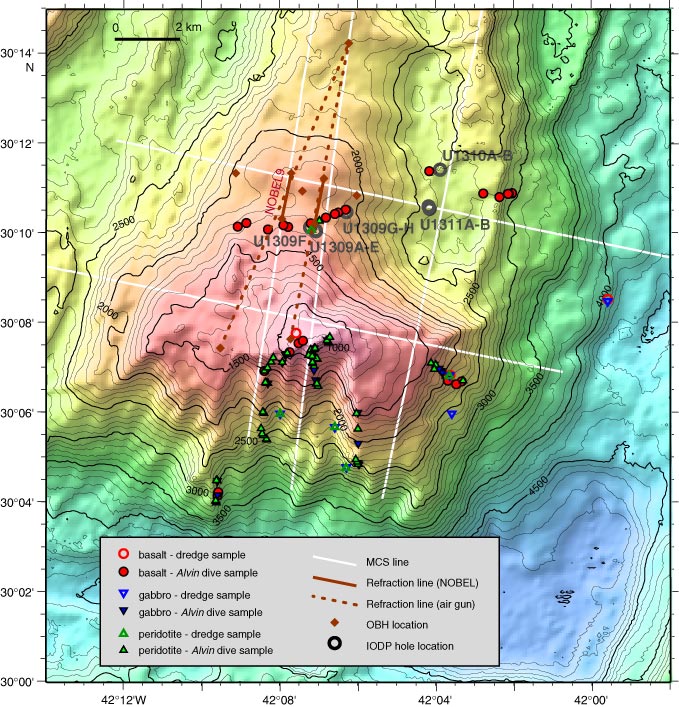
Figure F2. Basemap of Atlantis Massif showing prior geological and geophysical data coverage and the location of Integrated Ocean Drilling Program (IODP) drill sites (circles). Bathymetry is contoured at 20 m intervals, based on a 100 m grid. Seismic reflection and refraction lines and seafloor mapping/sampling sites are shown. Spreading-parallel multichannel seismic (MCS) Line Meg-9 follows the Southern Ridge; Meg-10 crosses the central dome. Line Meg-5 crosses the southeast shoulder of the massif and then subparallels the trend of the adjacent volcanic block. The corrugated detachment surface capping the central dome is inferred to extend beneath this eastern block, thereby making the upper crustal volcanics a hanging wall to the fault. OBH = ocean bottom hydrophone.