Next Section | Table of Contents
doi:10.2204/iodp.pr.311.2005
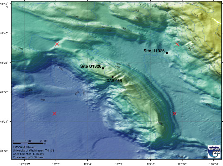
Figure F5. Multibeam bathymetry map over first accreted ridge documenting the collapse feature around Site U1326. Linear features, identified as faults from seismic data, cross the ridge in the central part (courtesy of D. Kelley, J. Delaney, and D. Glickson, University of Washington, and C. Barnes, C. Katnick, NEPTUNE Canada, University of Victoria; funded by the University of Washington and the W.M. Keck Foundation).