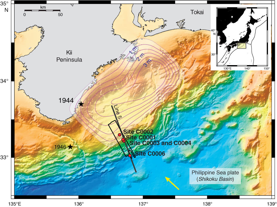
Figure F1. Kumano Basin region with Expedition 314 drill sites (red circles). Black box = location of the 2006 three-dimensional seismic survey, black line = KR0108-5 two-dimensional seismic survey, yellow arrow = far-field convergence vector between Philippine Sea plate and Japan (Seno, 1993; Heki, 2007).
Close | Next | Top of page