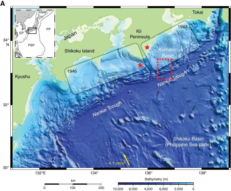
Figure F1. A. Nankai Trough off southwestern Japan, locus of Philippine Sea plate (PSP) subduction beneath Honshu and Shikoku islands. Yellow arrow = convergence direction between PSP and Japan. Rupture zones of 1944 and 1946 earthquakes are also shown. Stars = epicenter locations for earthquake nucleation. Red dashed box = B. In inset, EP = Eurasian plate, PP = Pacific plate, NAP = North American plate. (Continued on next page.)
Close | Next | Top of page