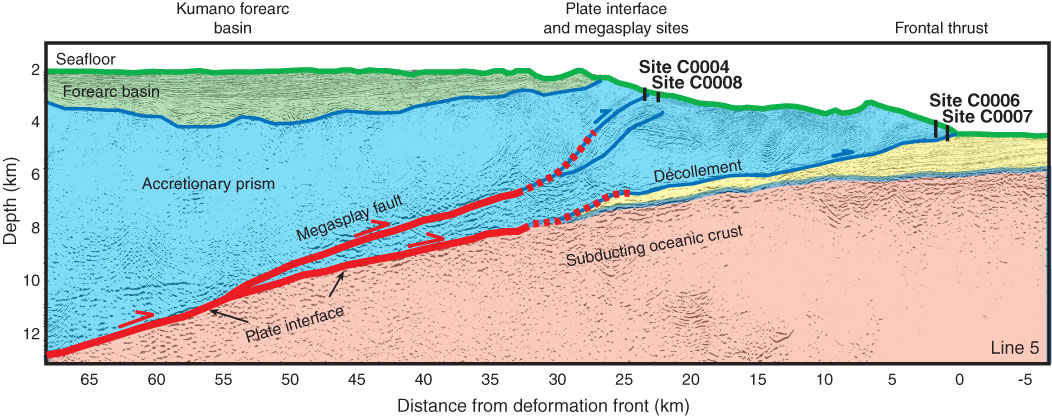
Figure F2. Interpretation of Line KR0108-5 (after Park et al., 2002) showing locations of sites cored during IODP Expedition 316. Extent of coseismic rupture in 1944 Tonankai M 8.2 earthquake determined from tsunami (Tanioka and Satake, 2001) and seismic (Kikuchi et al., 2003) waveform inversions are shown above the seismic line by red and blue arrows, respectively.
Previous | Close | Next | Top of page