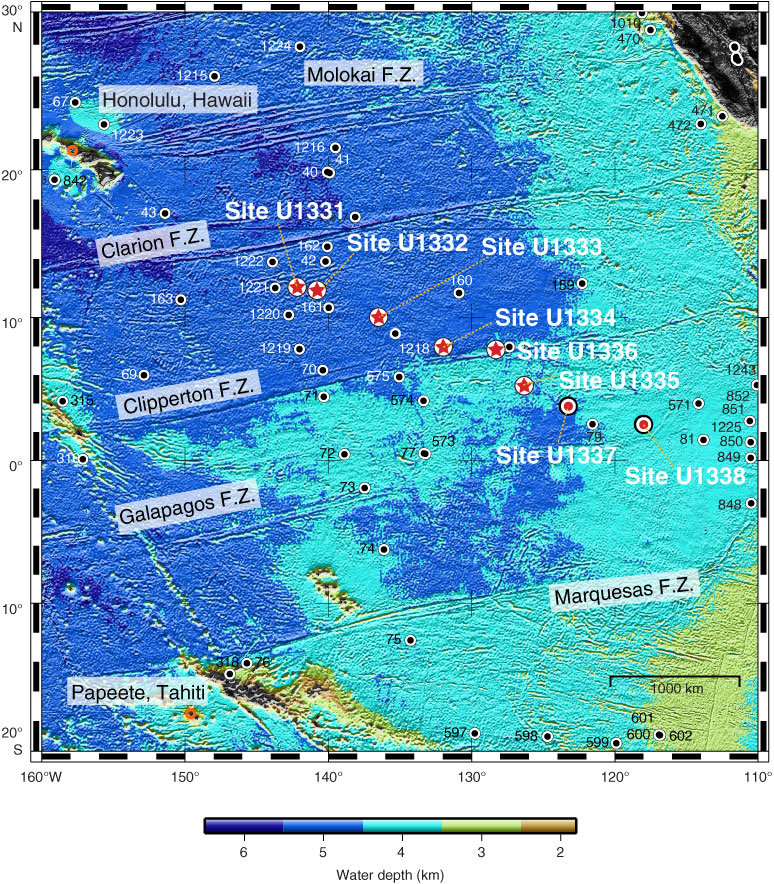
Figure F1. Location map of sites drilled during Expeditions 320 and 321. Red stars = sites drilled during Expedition 320, red circles = sites drilled during Expedition 321, black circles = previous DSDP and ODP sites. F.Z. = fracture zone. The positions of Honolulu and Papeete are indicated for orientation.

Close | Next | Top of page