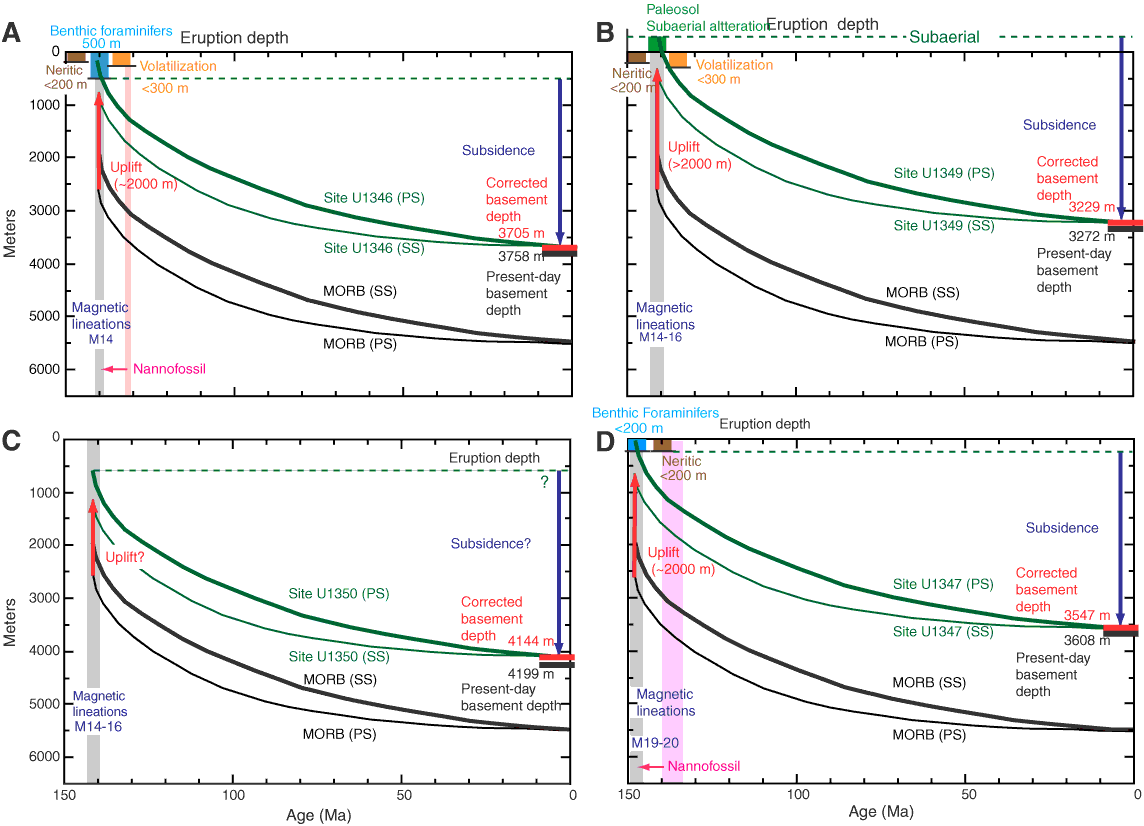
Figure F26. Subsidence curves, Expedition 324. A. Site U1346 (Shirshov Massif summit). B. Site U1349 (Ori Massif summit). C. Site U1350 (Ori Massif flank). D. Site U1347 (Tamu Massif flank). Colored curves = extrapolated site depth at the time of eruptions, calculated by backtracking from the present depth (corrected for sediment loading; Crough, 1983). PS = Parsons and Sclater (1977) model, SS = Stein and Stein (1994) model. Paleodepth estimates from backtracking are compared with paleodepth indicators from Expedition 324 cores. Black curves = normal mid-ocean ridges, red arrow = difference between normal ridge and observed paleodepth, taken as the amount of uplift caused by volcano construction. Magnetic lineation ages are from Nakanishi et al. (1999) and Gradstein et al. (2004).
Previous | Close | Next | Top of page