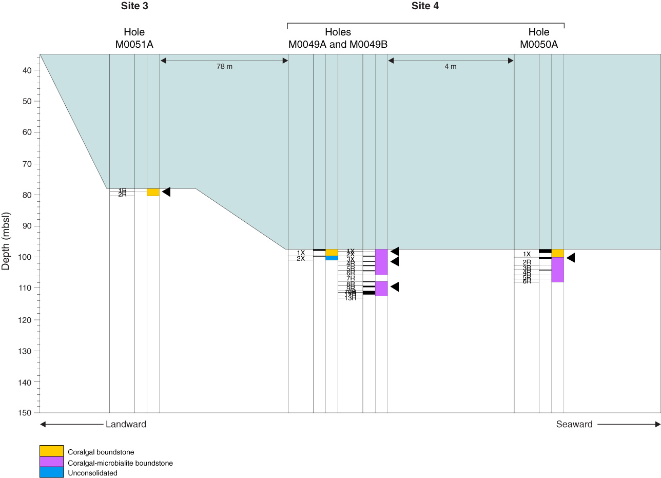
Figure F26. Transect summary of holes forming the RIB-02A transect showing recovery, facies units, location within each hole of core catcher samples taken for preliminary dating, and distance between each hole/group of holes, Expedition 325. Depth shown in meters below present-day sea level (LAT taken from corrected EM300 multibeam bathymetry).

Previous | Close | Next | Top of page