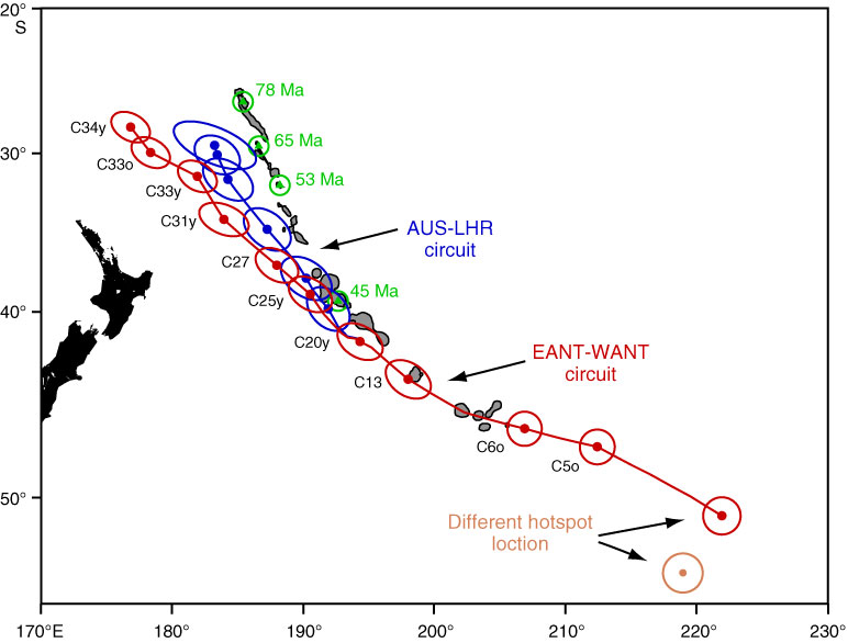
Figure F3. Predictions of the location of the Louisville hotspot track based on Indo-Atlantic data transferred to the Pacific plate via global plate circuits. Red = standard plate circuit (i.e., Cande et al., 1995) with transfer from the Atlantic Basin through East and West Antarctica (EANT-WANT), based on present-day hotspot location at 50.9°S, 138.0°W (Lonsdale, 1988). Blue = alternate plate circuit (Steinberger et al., 2004) with a transfer through the Lord Howe Rise (LHR). Orange = alternate location of present-day hotspot location at 53.5°S, 141.12°W (Epp, 1978; Wessel and Kroenke, 1997; no reconstruction shown for this alternate hotspot location). Reproduced from unpublished work by J. Tarduno, R. Cottrell, and P. Doubrovine (Rochester University). AUS = Australian plate.
Previous | Close | Next | Top of page