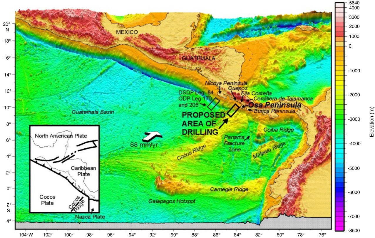
Figure F1. Bathymetric map of Middle America Trench, showing location of proposed drilling area. Note the collision of Cocos Ridge with the trench in the Osa Peninsula area, a process that brings the seismogenic zone within reach of IODP riser drilling capabilities. Elevation data compiled from Smith and Sandwell (1997).
Close | Next | Top of page