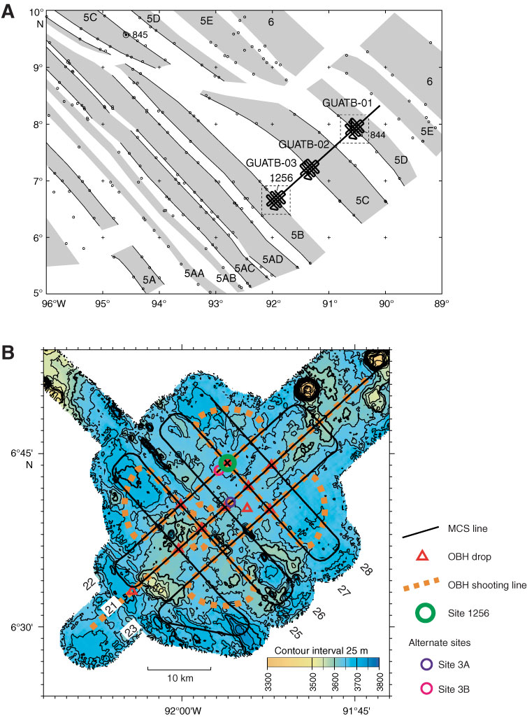
Figure F7. A. Details of isochrons inferred from magnetic anomalies near Site 1256. Shading shows normal magnetic polarity, based on digitized reversal boundaries (small circles, after Wilson, 1996). Bold line shows location of Guatemala Basin multichannel seismic (MCS) tracklines from the site survey Cruise EW9903 conducted in March–April 1999 (Wilson et al., 2003). Anomaly ages: 5A = ~12 Ma, 5B = 15 Ma, and 5D = ~17 Ma. B. Bathymetry and site survey track map for Site 1256 (proposed Site GUATB-03C). Abyssal hill relief of as much as 100 m is apparent in the southwest part of the area; relief to the northeast is lower and less organized. Line numbers 21–28 identify MCS lines from the site survey. OBH = ocean bottom hydrophone.
Previous | Close | Next | Top of page