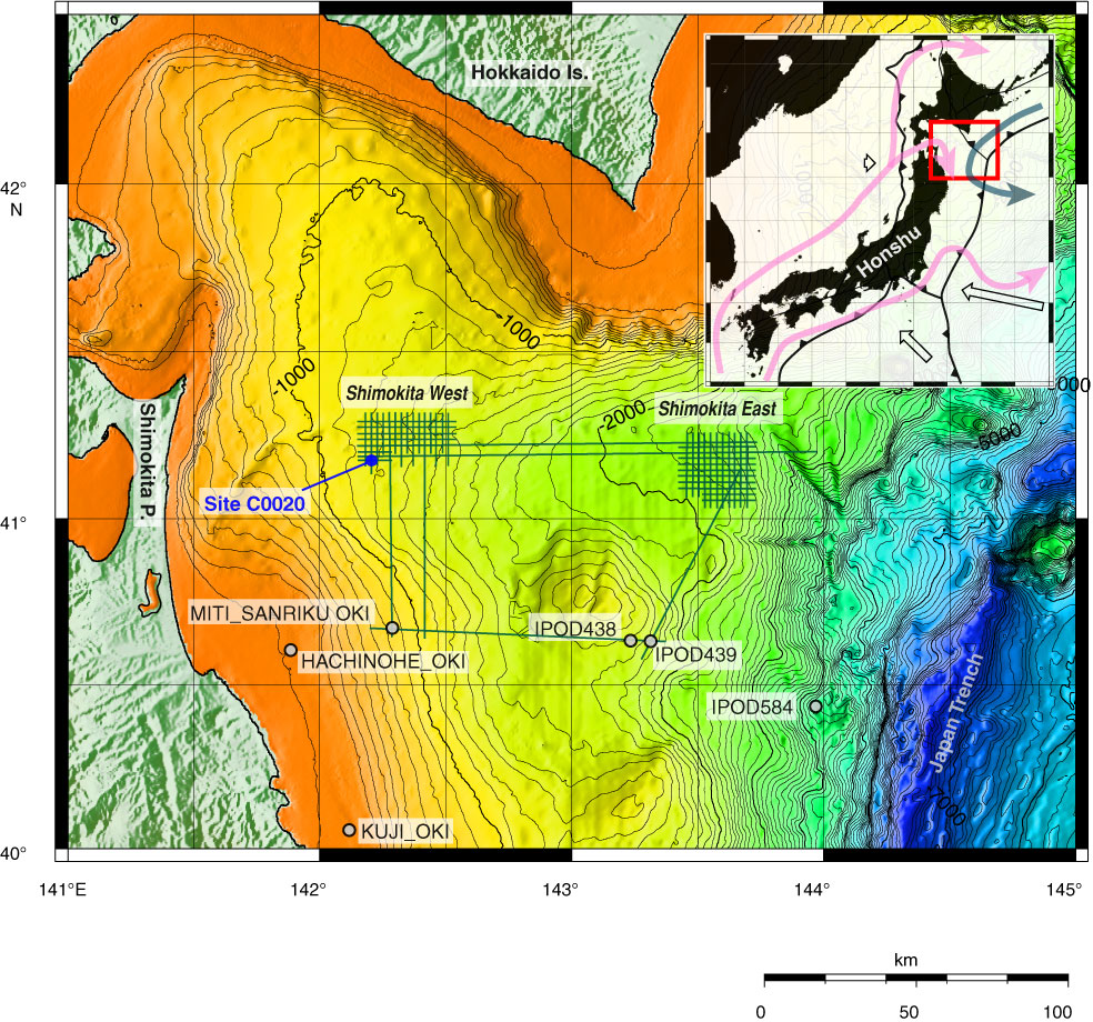
Figure F1. Index map of Site C0020 off the Shimokita Peninsula of Japan with bathymetry, seismic survey track lines, and locations of existing drill holes. Inset map exhibits plate configuration around Japanese Islands and the location of the index map (red square).
Close | Next | Top of page