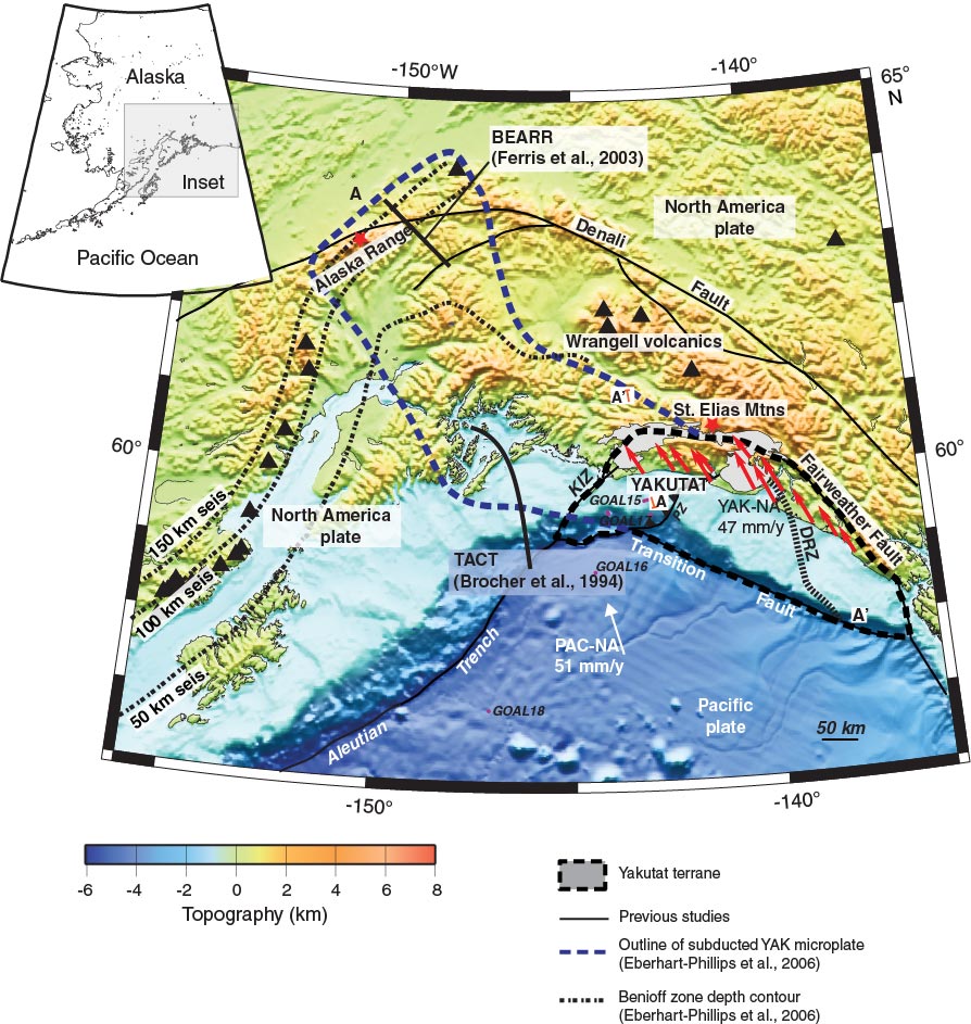
Figure F3. Regional tectonic map of southern Alaska showing major faults, topography, and geographic landmarks. Pacific plate velocity vector from Demets and Dixon (1999). Yakutat terrane velocity with regard to North America (YAK-NA) in red arrows (average = 47 mm/y; from Elliot et al., 2010). Blue dashed line shows extent of subducted Yakutat slab from Eberhart-Phillips et al. (2006). Black dashed outline shows currently defined Yakutat terrane. Benioff zone depth contours at 50, 100, and 150 km. KIZ = Kayak Island zone, DRZ = Dangerous River zone, TACT = Trans-Alaska Crustal Transect. PAC-NA = Pacific plate-North America plate convergence. Proposed drilling sites are shown. Figure from Worthington, 2010.
Previous | Close | Next | Top of page