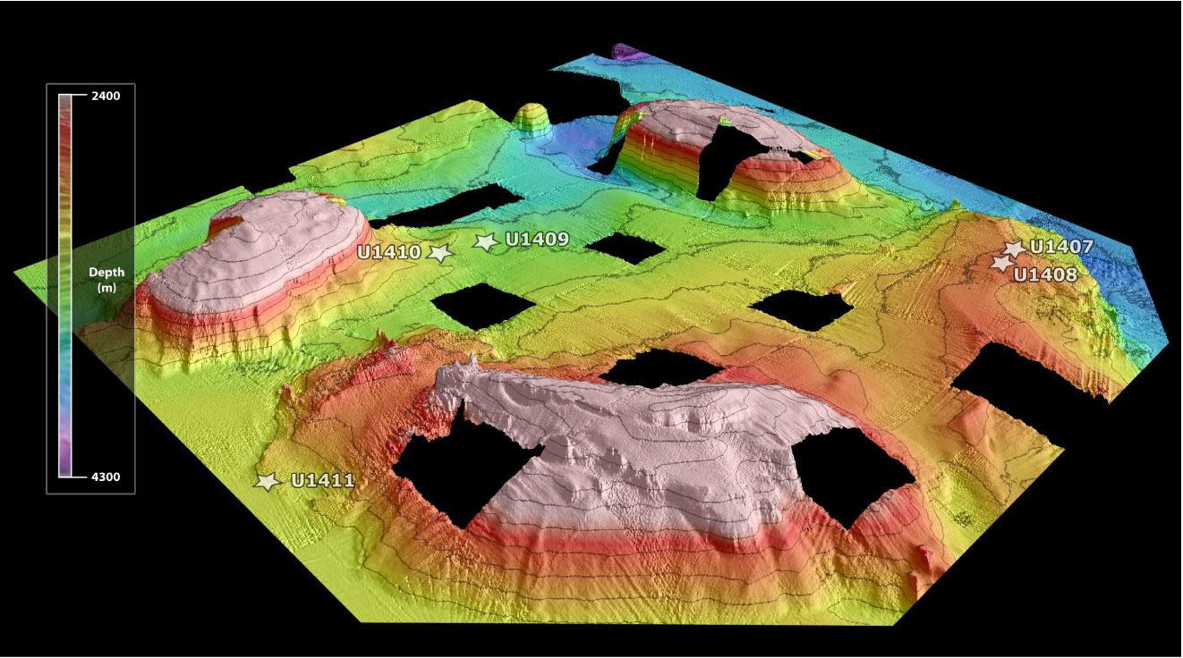
Figure F12. Multibeam bathymetric map of the seamount area of Southeast Newfoundland Ridge based on the site survey by the R/V Knorr (KNR179-1). Note the moat formed adjacent to the most distant seamount reflecting the long-term channeling of flow around the seamounts. Also note the partly sedimented seamount in the foreground, with basement exposures cropping out near the crest of the seamount and on its flanks. Expedition 342 drill sites (stars) are positioned on drifts that have developed as narrow piles of clay and nannofossil ooze either adjacent to the flow channels between seamounts (Sites U1409–U1411) or on ridge crests (Site U1407 and U1408).
Previous | Close | Next | Top of page