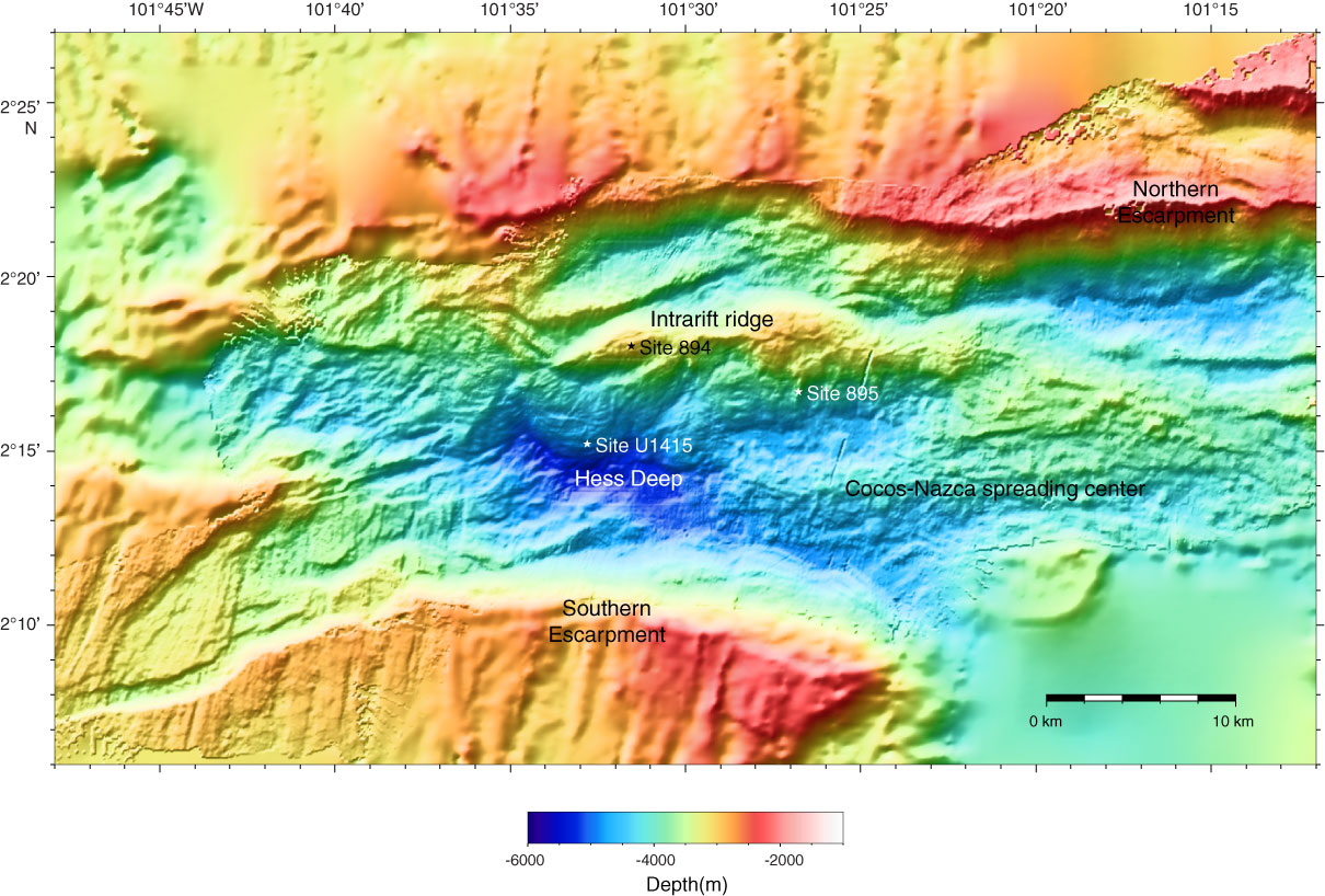
Figure F5. Regional bathymetric map of the Hess Deep Rift showing key morphological features and locations of IODP Expedition 345 Site U1415 and ODP Site 895. Regional multibeam bathymetry data were acquired using the hull-mounted Kongsberg Simrad EM120/SBP120 system (12 kHz). Swath data were gridded at between 50 and 150 m depending on the density of data coverage, with the smallest grid spacing in the center of Hess Deep, and combined with existing swath data in this region available from the Marine Geoscience Data System (www.marine-geo.org). Existing data were from cruises aboard the R/V Thomas Washington in 1982 (PI: P. Lonsdale), 1985 (PI: Lonsdale), and 1992 (PI: L. Dorman) and aboard the R/V Melville in 2000 (PI: D. Fornari) and 2002 (PI: E. Klein).
Previous | Close | Next | Top of page