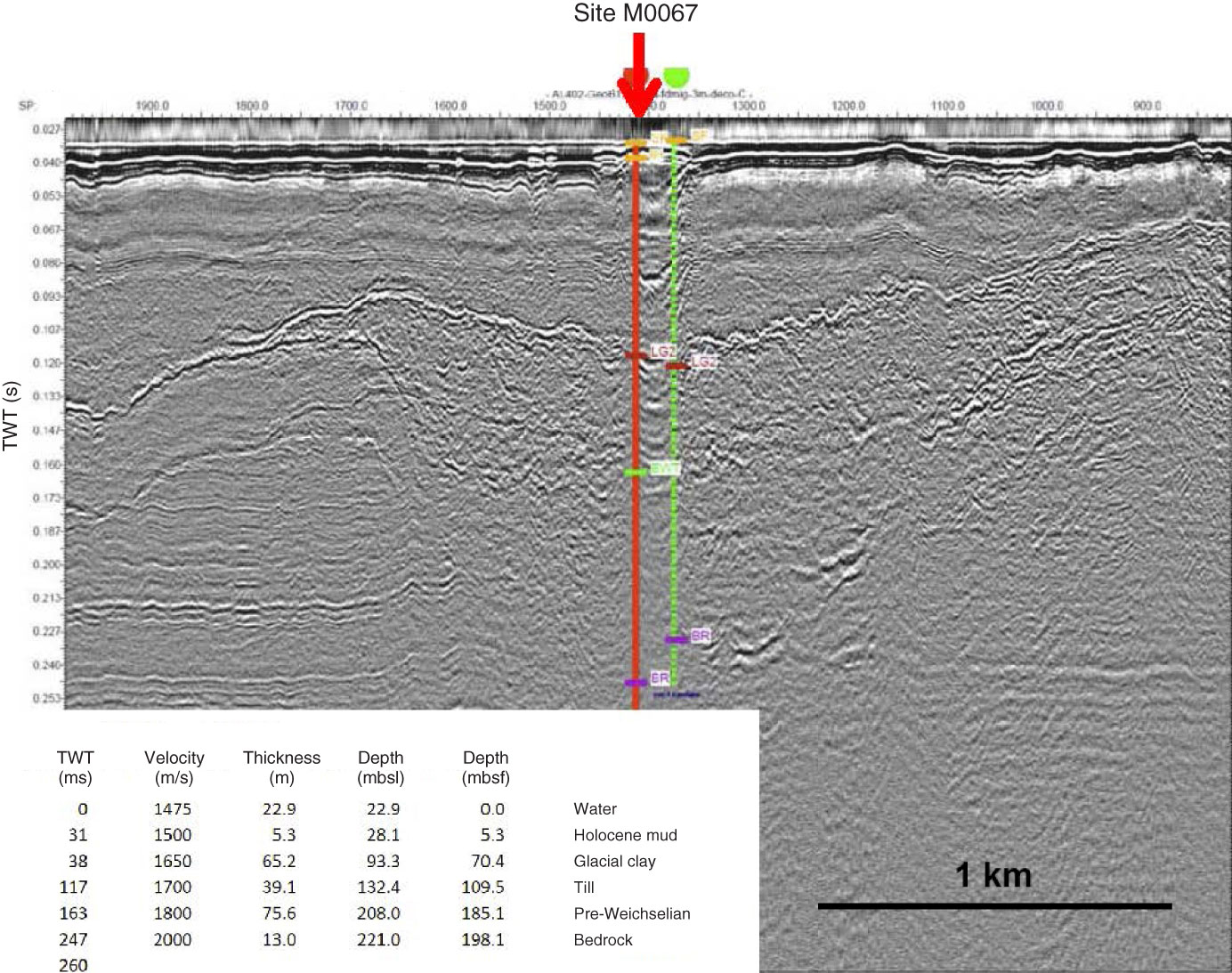
Figure F11. Seismic Line AL402-GeoB12-085 across proposed Site BSB-4 (green) and at ~250 m distance from Site M0067 (red). Original interpretation of the seismic transect: SF = seafloor, LG2 = bottom of late glacial Unit II (varved glacial clay), BWT = bottom of Weichselian till, BR = bedrock. SP = shot point. TWT = two-way traveltime.
Previous | Close | Next | Top of page