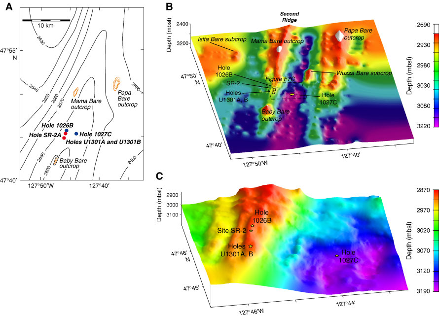
Figure F7. Bathymetric relief maps of the Second Ridge area. A. Bathymetry showing generally flat seafloor, with outcrops and ODP and IODP drill sites. B. Basement relief map created from seafloor and seismic data, showing the outcrops and general basement structure. White areas indicate basement outcrops that rise above the surrounding seafloor. C. Basement detail map of Second Ridge drill sites.