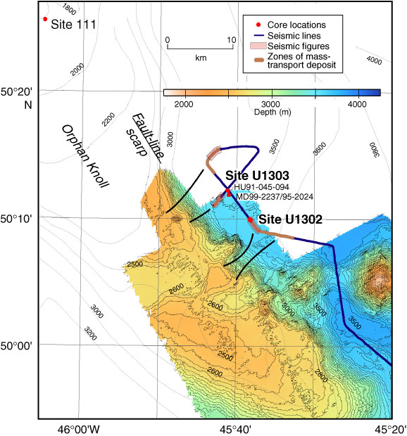
Figure F3. Bathymetric map of the site survey shiptrack close to Sites U1302 and U1303. Arrows indicate conduits for mass transport deposits (from Toews and Piper, 2002) (50 m contour lines on multibeam bathymetry image).
Previous | Close | Next | Top of page