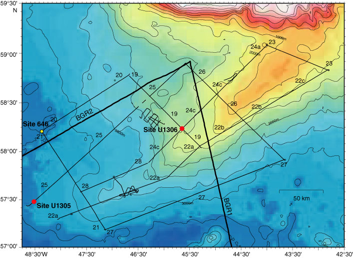
Figure F3. Map of multichannel seismic lines collected during Knorr Cruise KN166-14 in 2002, relative to the seismic lines collected in 1977 by BGR1 and BGR2. The location of the deepwater site (Site U1305) and the shallower water site (Site U1306) are shown relative to the location of ODP Site 646 (Mountain et al., unpubl. data).
Previous | Close | Next | Top of page