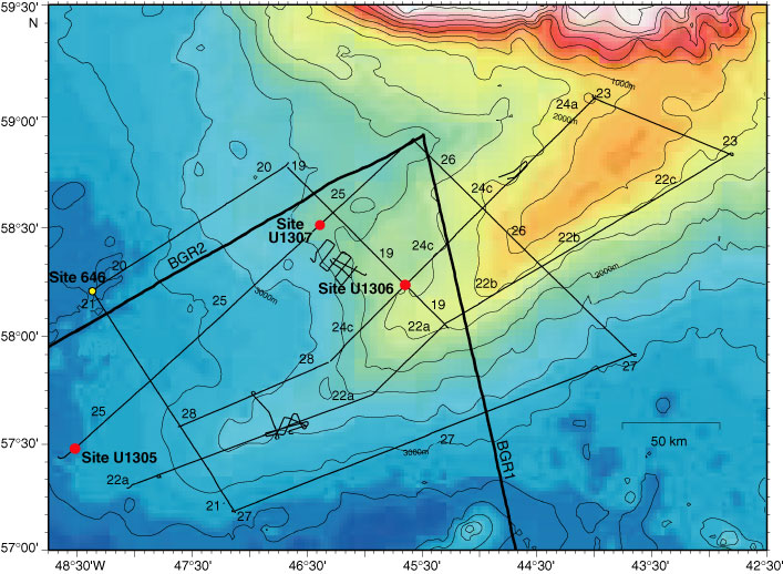
Figure F1. Map of multichannel seismic lines collected during Knorr cruise KN166-14 in 2002, relative to the seismic lines collected in 1977 by BGR1 and BGR2. The location of the deepwater site (Site U1305) and the shallower-water sites (Sites U1306 and U1307) are shown relative to the location of Site 646 (Mountain et al., unpubl. data).
Close | Next | Top of page