Previous | Close | Next
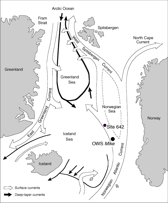
Figure F3. Location map of Norwegian Sea and Vøring Plateau showing Site 642 and Ocean Weather Ship Station (OWS) station Mike (modified from Gammelsrød et al., 1992).
Previous | Close | Next | Top of page