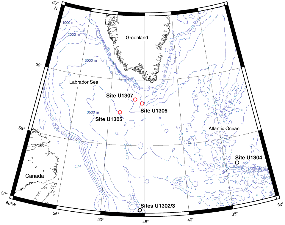
Figure F1. Map showing locations of sites used in this study that were drilled during Expedition 303. Red circles = sites investigated for interstitial water carbon stable isotopes in this report. Bathymetric contours are in meters below sea level. This map was generated using Generic Mapping Tools (Wessel and Smith, 1998).
Close | Next | Top of page