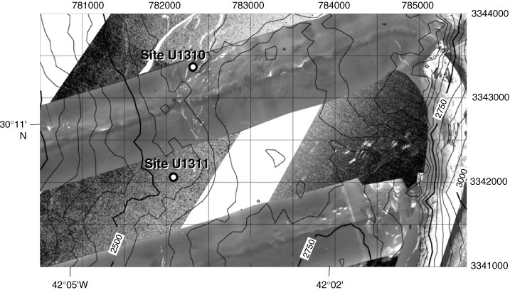
Figure F36. Setting of hanging wall sites. The area shown is 5 km × 3 km; each gridbox = 500 m. Universal Transverse Mercator (UTM) Zone 23 and latitude/longitude coordinates are labeled. Side-scan sonar data are overlain by bathymetric contours (50 m interval), which show the eastern scarp of the hanging wall that drops steeply into the median valley, the relatively gentle topography on the top of the block, and the break in slope from the lower central dome. Sites U1310 and U1311 are both near this inferred contact between the footwall and hanging wall. The side-scan data show several high backscatter features (white) that mark scarps. Several small volcanic mounds can also be recognized from high reflectivity on one side and a small shadow on the other side.
Previous | Close | Next | Top of page