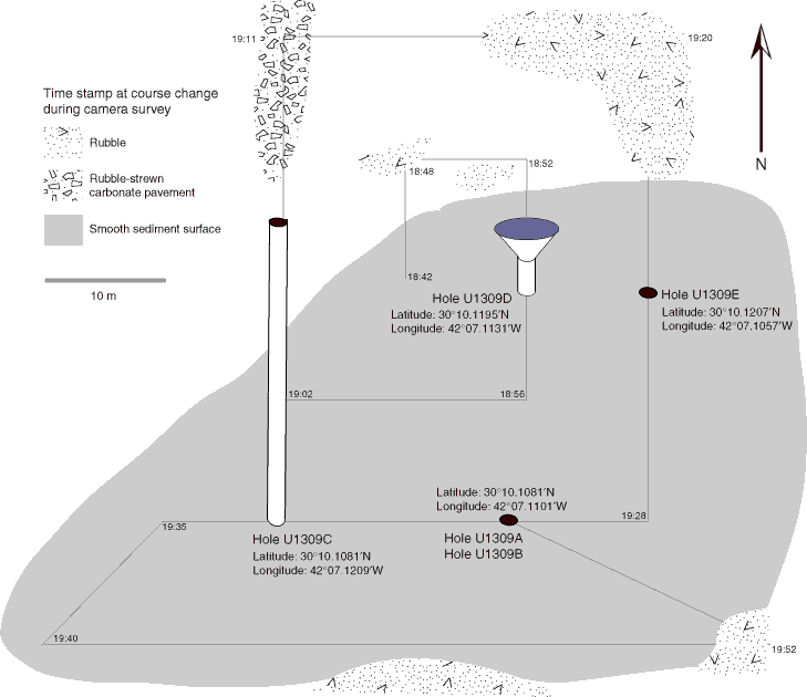
Figure F304. Map of Hole U1309D operations area developed from subsea camera survey observations. The initial survey began at 1842 h on 24 November 2004, following the expanding box pattern illustrated by the straight lines (the actual path of the camera is not plotted, but tracking the camera via sonar indicated the camera followed the ship’s path). Seafloor hardware is not to scale. Cylinder in Hole U1309C represents ~25 m of casing left standing above the seafloor.
Previous | Close | Top of page