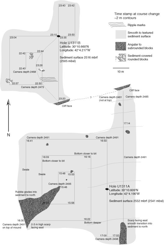
Figure F1. Map of Site U1311 operations area developed from subsea camera survey observations. The survey for Hole U1311A began at 1546 h on 18 December, following the expanding box illustrated by the straight lines in the lower part of the figure (the actual path of the camera is not plotted, but tracking the camera via sonar indicated the camera followed the ship's path). Hole U1311A was initiated on the east side of our survey area, in a smooth sediment blanket with no obvious talus present. Hole U1311B was spudded ~104 m north of Hole U1311A, in 36 m shallower water depth (above the cliff face seen during the survey for Hole U1311A). Camera depths are in meters below sea level (mbsl). mbrf = meters below rig floor.