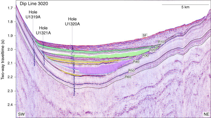
Figure F26. Dip-oriented seismic line across Brazos-Trinity Basin IV with LWD resistivity (RING) logs. Depth scale in the well logs were converted to time using the check shot survey in Hole U1320A. This time-depth curve was also used for Sites U1319 and U1321. SF = seafloor.
Previous | Close | Next | Top of page