Close | Next
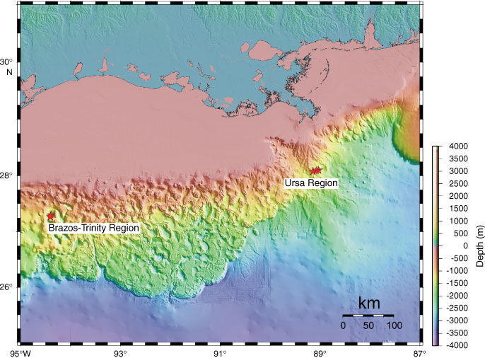
Figure F1. Bathymetric map of the Gulf of Mexico and the two drilling areas (Brazos-Trinity and Ursa) in this study.
Close | Next | Top of page