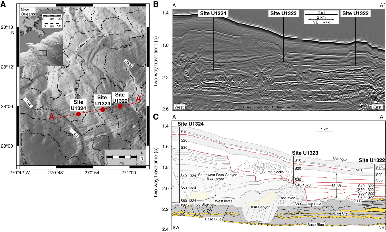
Figure F1. A. IODP Expedition 308 site locations (red circles) and bathymetry contours. Ursa Basin is located 210 km southeast of New Orleans, Louisiana, USA (inset map). Contour interval = 100 m. B. East–west seismic cross section A–A′ (located in A). VE = vertical exaggeration. C. Interpreted cross section A–A′. Light and dark gray = mud-rich levee, rotated channel-margin slides, and hemipelagic drape; yellow = sand-rich channel fill. Blue Unit (light blue) composed of sand and mud. Mass transport deposits (MTDs) have occurred in the mud-rich levee deposits above the Blue Unit. Red = detachment surfaces.
Close | Next | Top of page