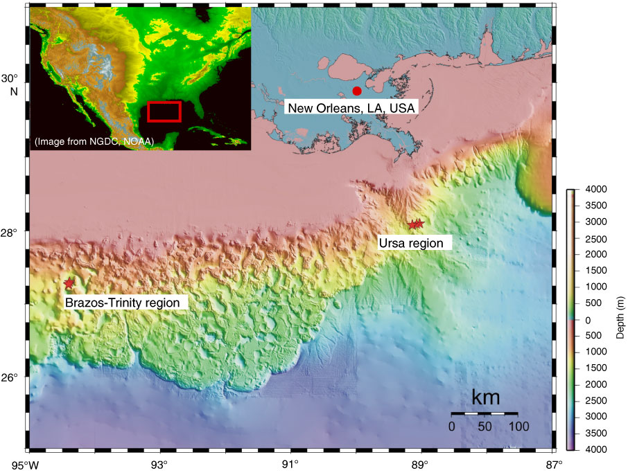
Figure F1. Basemap of the study areas on the continental shelf, Gulf of Mexico. Brazos-Trinity Basin IV is 200 km due south of Galveston, Texas, USA, in ~1400 m of water. Ursa Basin is ~200 km southeast of Louisiana, USA, in ~1000 m of water. NGDC = National Geophysical Data Center, NOAA = National Oceanic and Atmospheric Administration.
Close | Next | Top of page