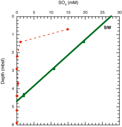
Figure F27. Sulfate profiles for the upper 6 m of Holes U1325B and U1325D, showing the estimated depth of the sulfate/methane interface between 4 and 5 mbsf based on data from Hole U1325D (solid line, green squares). Hole U1325B (dashed line, red circles) apparently missed the mudline by ~3 m. SW = seawater.
Previous | Close | Next | Top of page