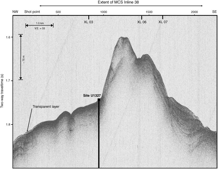
Figure F3. High-resolution 3.5 kHz subbottom profiler data acquired along Inline 38 of the 3-D survey, showing the absence of the typical Holocene transparent layer near Site U1327. MCS = multichannel seismic, V.E. = vertical exaggeration.

Previous | Close | Next | Top of page