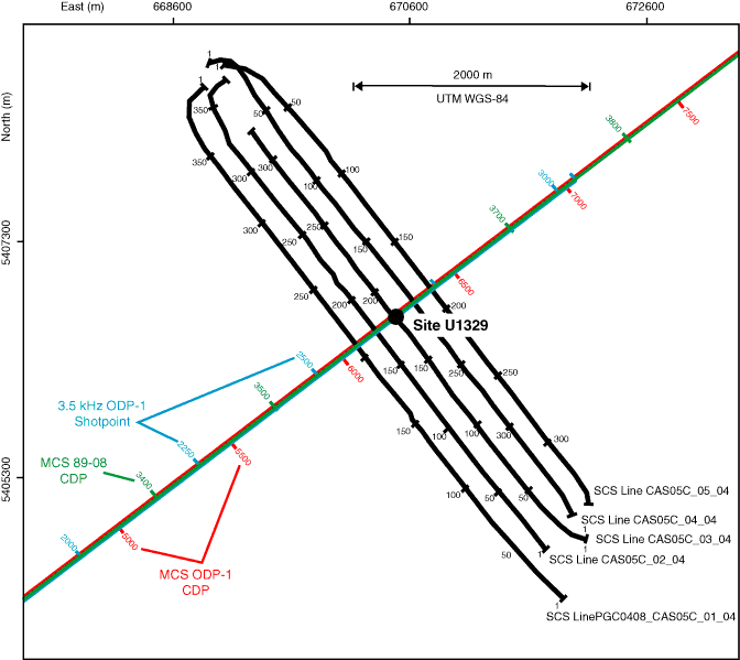
Figure F1. Seismic site survey data in the vicinity of Site U1329. There are two seismic lines acquired virtually over the same location: multichannel seismic (MCS) Line 89-08 (from the presite survey for ODP Leg 146) and Line PGC9902_ODP-1 with MCS and 3.5 kHz subbottom profiler data. Shotpoints and common depth points (CDPs) are indicated in different colors. Green = Line 89-08 CDPs, red = Line PGC9902_ODP-1 MCS CDPs, blue = Line PGC9902_ODP-1 3.5 kHz data shot points. SCS = single channel seismic. Axes are universal transverse Mercator (UTM) projection easting and northing coordinates using the WGS-84 reference.
Close | Next | Top of page