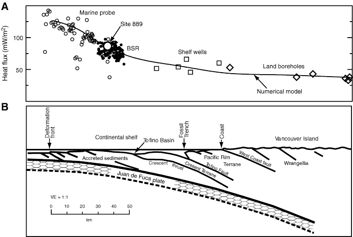
Figure F2. A. Heat flow data in the 100 km wide LITHOPROBE corridor across the southern Vancouver Island margin. The predicted heat flow from numerical modeling is shown for comparison. BSR = bottom-simulating reflector. B. Offshore–onshore structural cross section across the southern Vancouver Island margin in the LITHOPROBE corridor.
Previous | Close | Next | Top of page