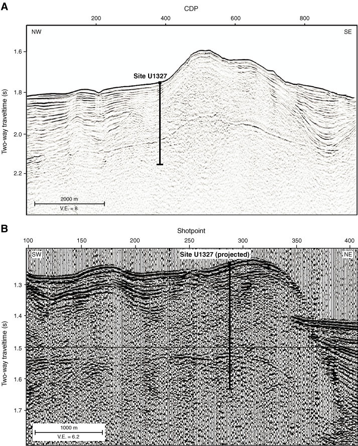
Figure F10. A. Time-migrated section of Inline 38 (COAMS data) of the pseudo 3-D grid. A clear BSR is present below the topographic high, formed of accreted sediments. A clear boundary between the reflective slope basin sediments and the seismically incoherent accreted sediments is imaged. The boundary between these two types was mapped over the 3-D grid and is shown in Figure F11B. CPD = common depth point. B. SCS Line PGC0503_CAS01B_02, parallel to and 500 m south of MCS Line 89-08. V.E. = vertical exaggeration.
Previous | Close | Next | Top of page