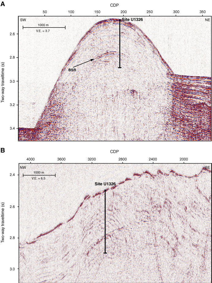
Figure F5. A. Segment of SCS Line PGC0408_CAS03B_X04 crossing Site U1326. Here a clear bottom-simulating reflector (BSR) is seen underneath the summit of the ridge. B. Segment of MCS Line CAS03 imaging the ridge in a northwest–southeast direction. CPD = common depth point, V.E. = vertical exaggeration.
Previous | Close | Next | Top of page