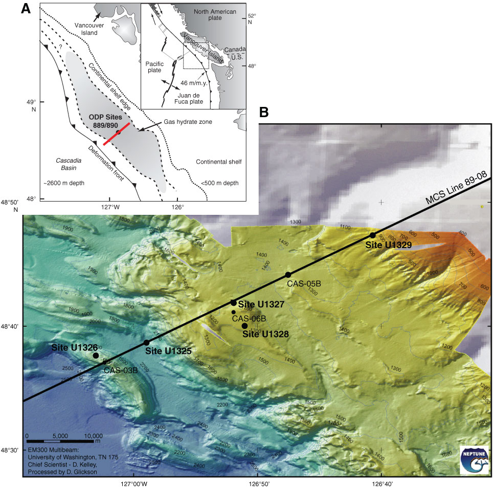
Figure F1. A. Map of plate tectonic setting of the Cascadia margin with general location of the drilling transect near previous ODP Sites 889/890. Bottom-simulating reflector is present on ~50% of the midcontinental slope (shaded area) (from Riedel et al., 2006). B. Multibeam bathymetry map along the transect across the accretionary prism, showing the location of the drilling transect (Sites U1326, U1325, U1327, U1329), cold vent Site U1328, and multichannel seismic (MCS) Line 89-08 (Courtesy of D. Kelley, J. Delaney, and D. Glickson, University of Washington and C. Barnes and C. Katnick, Neptune Canada, University of Victoria; funded by the University of Washington and the W.M. Keck Foundation).
Close | Next | Top of page