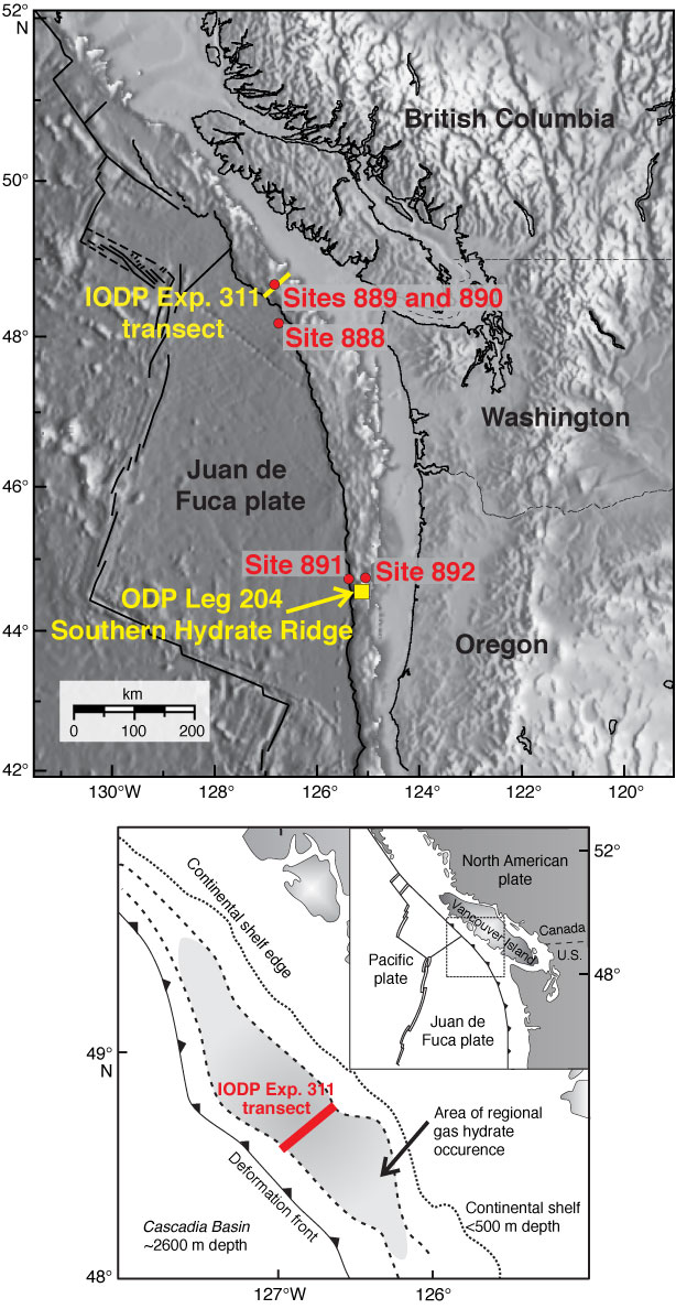
Figure F1. Map of the Cascadia continental margin. Shown are the research sites established by Ocean Drilling Program (ODP) Legs 146 and 204 and Integrated Ocean Drilling Program (IODP) Expedition 311. The inset shows the inferred regional distribution of gas hydrate along the northern Cascadia margin (shaded area) from the occurrence of a bottom-simulating reflector as well as the general plate-tectonic regime of the northern Cascadia subduction zone (after Hyndman et al., 2001).
Close | Next | Top of page