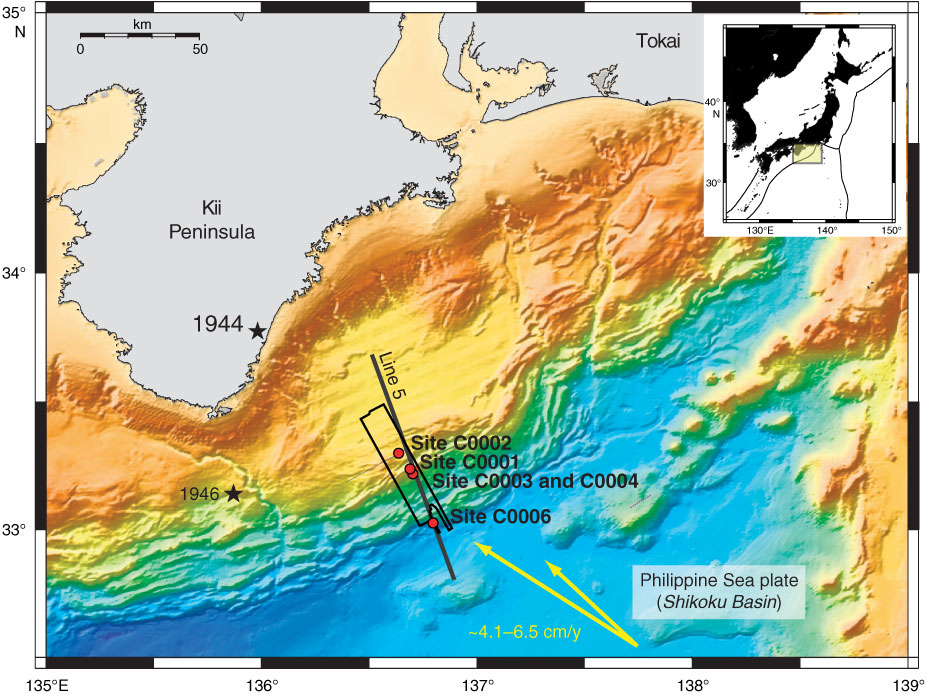
Figure F1. Location of sites drilled during Expedition 314 (red circles) in the Nankai Trough off Kumano, Japan. Black box = location of the 2006 three-dimensional seismic survey, black line = KR0108-5 two-dimensional seismic survey, yellow arrows = computed far-field convergence vectors between Philippine Sea plate and Japan (Seno, 1993; Heki, 2007). Stars = epicentral location of great earthquakes. Inset shows location of Nankai Trough around the drill sites.
Close | Next | Top of page