Close | Next
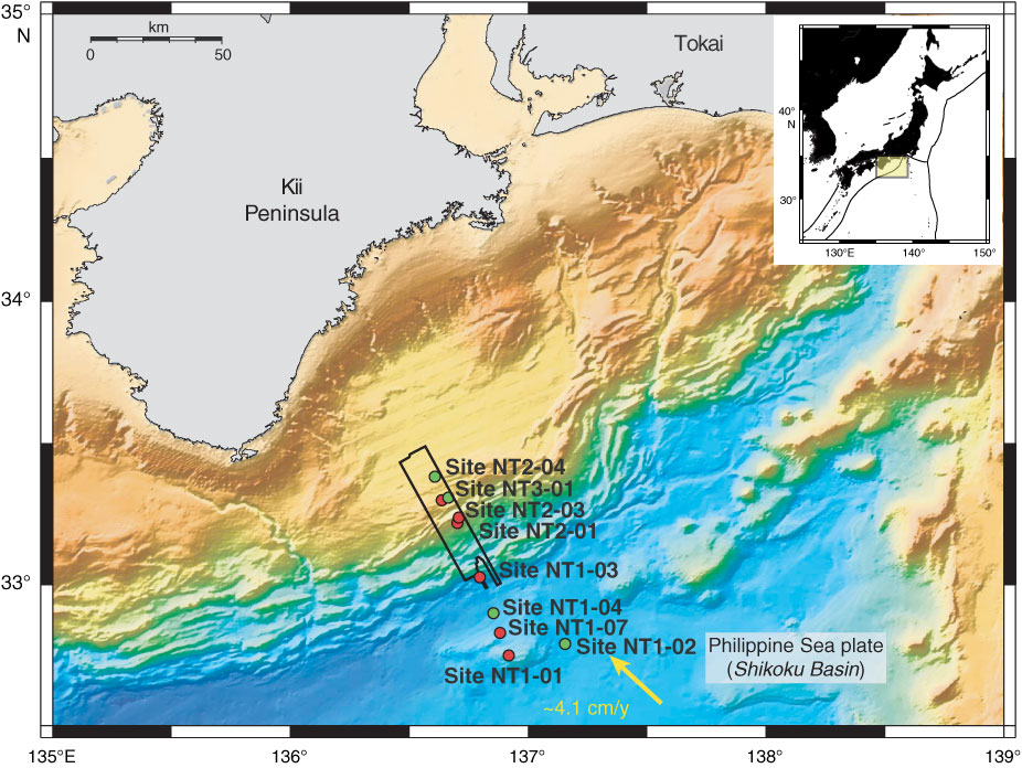
Figure F1. Map of Kumano Basin region with proposed Stage 1 drill sites. Red dots = primary sites, green dots = alternate sites, black outline = 3-D seismic volume region.
Close | Next | Top of page