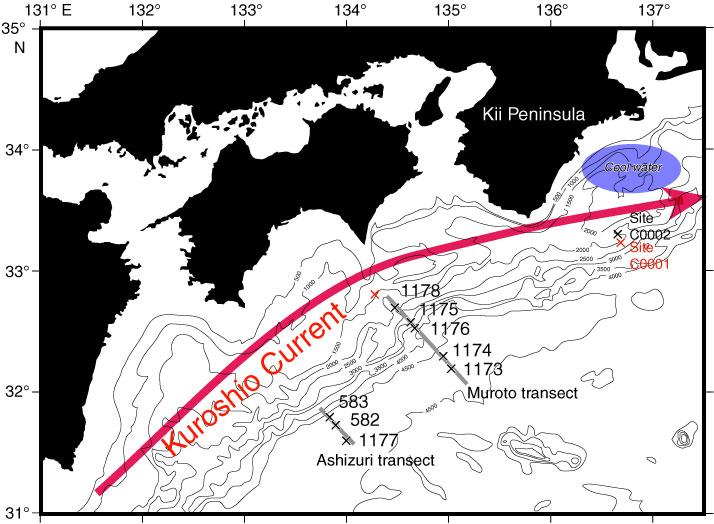
Figure F1. Map showing the Site C0001 with previous ODP and DSDP sites in and around the Nankai Trough, northwestern Pacific Ocean. Topographic data are distributed from the Hydrographic and Oceanographic Department, Japan Coast Guard. Blue oval marks the area of coastal upwelling around Site C0001.
Close | Next | Top of page