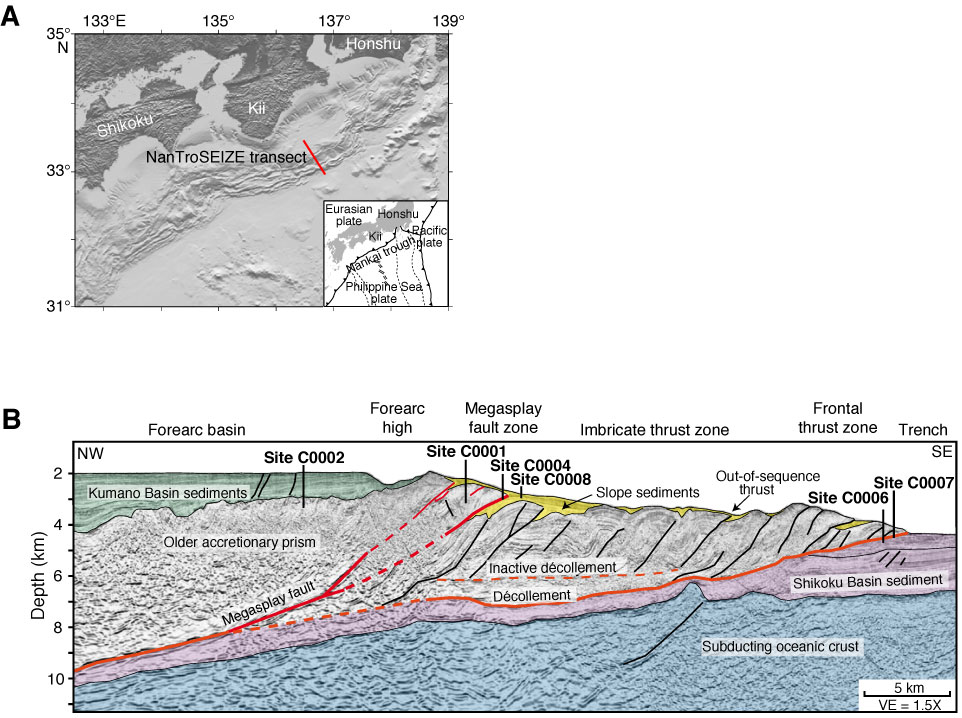
Figure F1. A. Map of the Nankai Trough study area including the Nankai Trough Seismogenic Zone Experiment (NanTroSEIZE) Stage 1 drilling transect (red line) in the Kumano Basin area, Japan. Inset shows overall plate tectonic setting. B. Regional long seismic reflection depth line (after Park et al., 2002) with drilled NanTroSEIZE Stage 1 sites and major interpreted tectonic features. After Tobin et al. (2009a) and Strasser et al. (2009). VE = vertical exaggeration.
Close | Next | Top of page