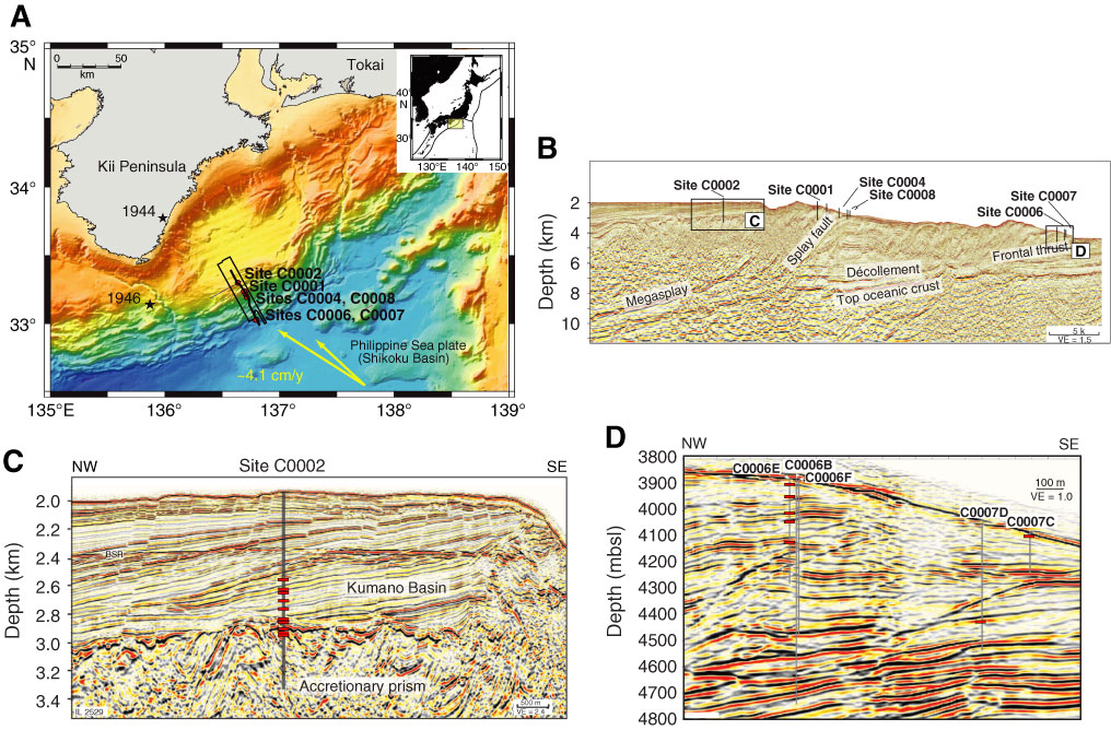
Figure F1. A. Map of the Kumano transect region with NanTroSEIZE Stage 1 drill sites. B. Seismic inline section from 3-D survey showing locations of Sites C0002, C0006, and C0007 (from the “Expedition 315 Site C0002” [Expedition 315 Scientists, 2009], “Expedition 316 Site C0006” [Expedition 316 Scientists, 2009b], and “Expedition 316 Site C0007” [Expedition 316 Scientists, 2009c] chapters). C. Sample locations at Site C0002 (red boxes) plotted on seismic section. D. Sample locations at Sites C0006 and C0007 (red boxes) plotted on seismic section.
Close | Next | Top of page