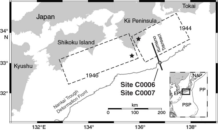
Figure F1. Nankai Trough with location of Sites C0006 and C0007 and rupture areas (dashed boxes), and epicenters (stars) of the 1944 Tonankai and 1946 Nankai earthquakes (modified from Kimura et al., 2008). EP = Eurasian plate, PSP = Philippine Sea plate, PP = Pacific plate, NAP = North American plate.
Close | Next | Top of page