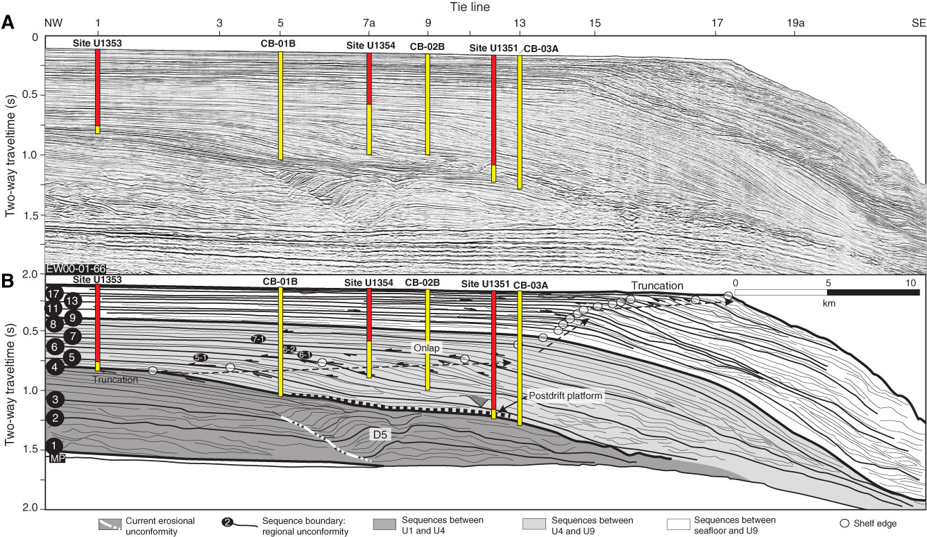
Figure F7. A. Uninterpreted multichannel seismic (MCS) dip Profile EW00-01-66 (southern part of survey grid) showing the locations of Sites U1351, U1353, and U1354. Proposed alternate Sites CB-01B, CB-02B, and CB-03A are also shown (see Fig. F3 for location). Red = actual penetration, yellow = proposed penetration. B. Interpretation showing seismic sequence boundaries and selected locations of onlap, truncation, and downlap (arrows). Circles = clinoform rollovers, or breaks, representing paleoshelf edges. Paleoshelf edges from seismic sequence boundaries U4 to U8 prograde steadily. Progradation decreases from U8 to U12, increasing again from U13 to U19. U4–U8 are onlapped and truncate underlying reflections; internal reflection geometries from U4 to U9 are mainly sigmoid. In contrast, U10–U19 are downlapped on paleoshelves but also truncate underlying reflections, and internal reflection geometries from U9 to the seafloor are oblique. Site U1351 sampled the paleoslopes of U6–U7 and sampled U8–U19 landward of their paleoshelf edges. Sites U1353 and U1354 sampled U5–U18 landward of their paleoshelf edges in a more proximal setting. Sediment drift development in this area largely ceased by U4. Only drift D5, capped by a postdrift slope platform at U4, was present. Prograding clinoforms dominate later sequences, and the slope steepens to 3°–5°. Drifts migrate northwestward (landward) on dip profiles. Erosional unconformities at the landward edges of drift moats are diachronous and intersected by multiple sequence boundaries.
Previous | Close | Next | Top of page