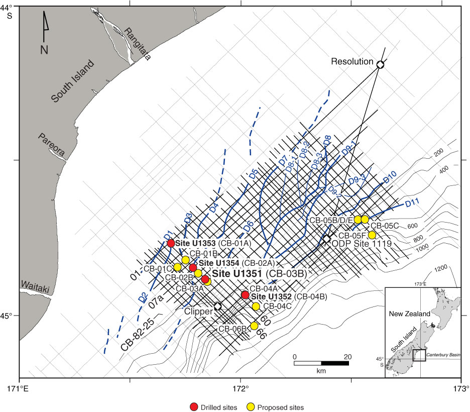
Figure F2. Map of drilled and proposed Expedition 317 sites, together with EW00-01 high-resolution (frequencies up to 300 Hz) multichannel seismic (MCS) grid (thick straight lines), low-resolution CB-82 commercial MCS grid (thin straight lines), exploration wells Clipper and Resolution, and Ocean Drilling Program (ODP) Site 1119. The EW00-01 survey was designed to provide improved vertical resolution (~5 m in the upper 1 s) to enhance our ability to define high-frequency sedimentary sequences. Also shown is the distribution of seismically resolvable sediment drifts D1–D11, along with D8 and D9 subdrifts. Blue curved lines = crests of drift mounds, dashed blue lines = drifts identified on CB-82 profiles. Dip Profiles EW00-01-66, EW00-01-60, EW00-01-01, EW00-01-07a, and CB-82-25 are also labeled.
Previous | Close | Next | Top of page