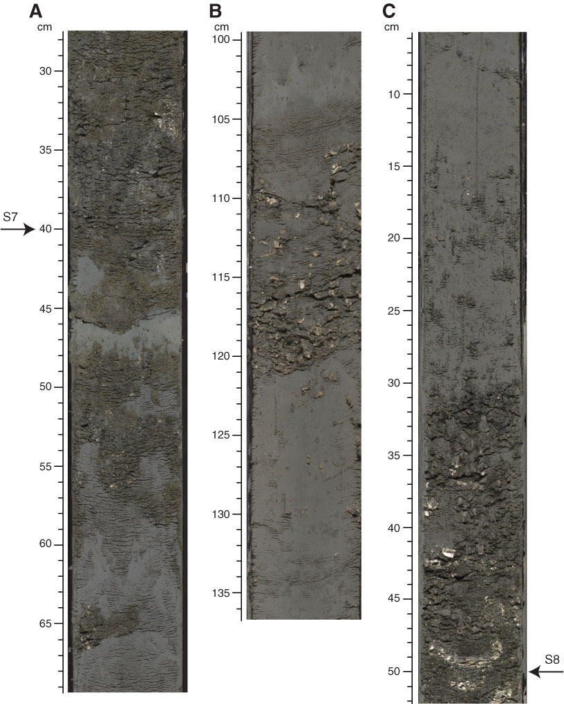
Figure F11. Core photographs showing Unit I/II boundary options. A. Option A (preferred) (Section 317-U1353B-28H-2, 46 cm [151.36 m]), where a pronounced burrowed contact is taken to represent the base of Unit I. Burrows at this contact are filled with sandy marl from the overlying lithology and extend 20 cm into the underlying mud. B. Option B (Section 317-U1353B-24H-2, 121 cm [137.07 m]), where a silty mud with common shells occurs above a bioturbated mud. C. Option C (Section 317-U1353B-34H-2, 32 cm [178.82 m]), where a folded clay-rich muddy interval rests sharply on a muddy shelly fine sand.

Previous | Close | Next | Top of page