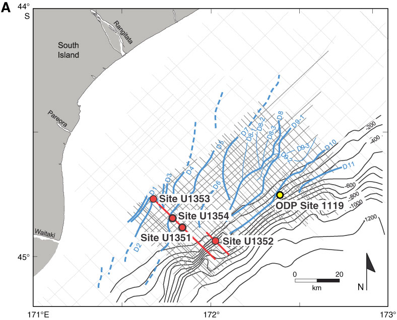
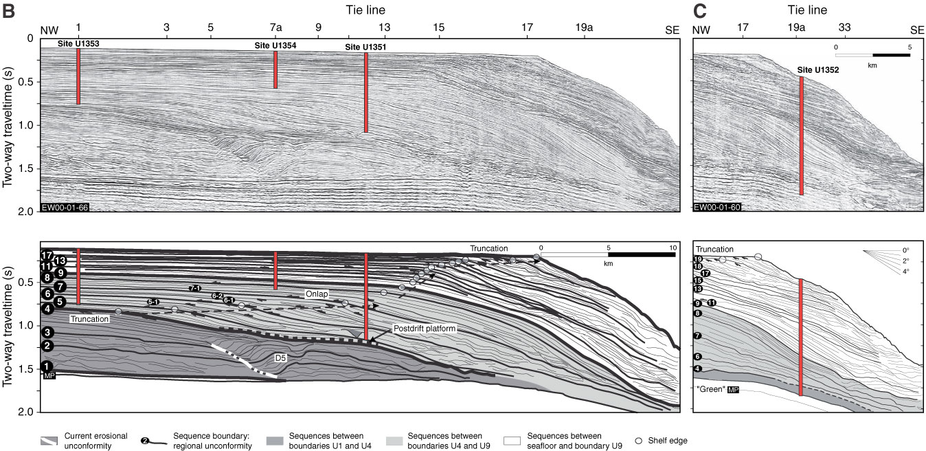
Figure F1. A. Map of the Canterbury Basin on eastern margin of South Island, New Zealand, showing location of study area and boreholes (after Expedition 317 Scientists, 2011). ODP = Ocean Drilling Program. B. Seismic dip Profile EW00-01-66 across the shelf showing locations of Sites U1351, U1353, and U1354. C. Profile EW00-01-60 across the slope showing location of Site U1352 (after Expedition 317 Scientists, 2011). MP = Marshall Paraconformity.
Close | Next | Top of page