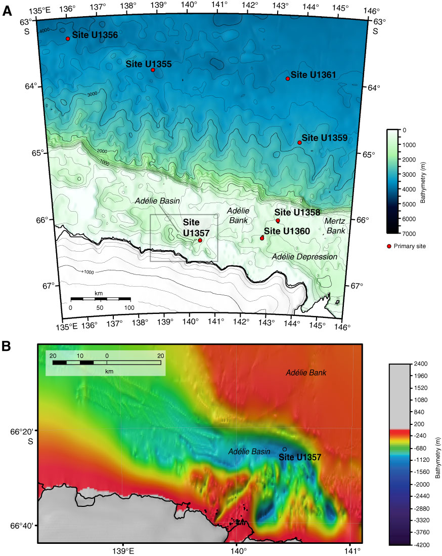
Figure F9. A. Bathymetric map of eastern Wilkes Land margin showing the location of Site U1357 and other Expedition 318 drill sites. Contour interval = 250 m. Box = approximate area of B. B. Bathymetric map of eastern Wilkes Land margin showing location of Site U1357 (black circle) and areas north and west of Adélie Basin.
Previous | Close | Next | Top of page