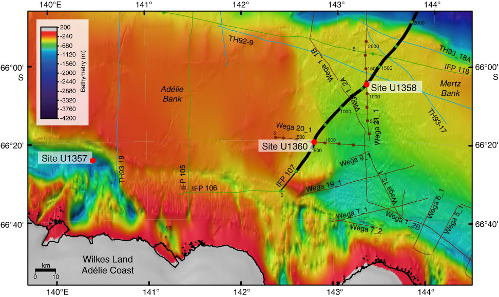
Figure F1. Bathymetric map of eastern Wilkes Land continental shelf showing the location of Sites U1357, U1358, and U1360. Bold black line = multichannel seismic reflection Profile IFP 108 shown in Figure F2 and Figure F2 in the “Site U1358” chapter.
Close | Next | Top of page