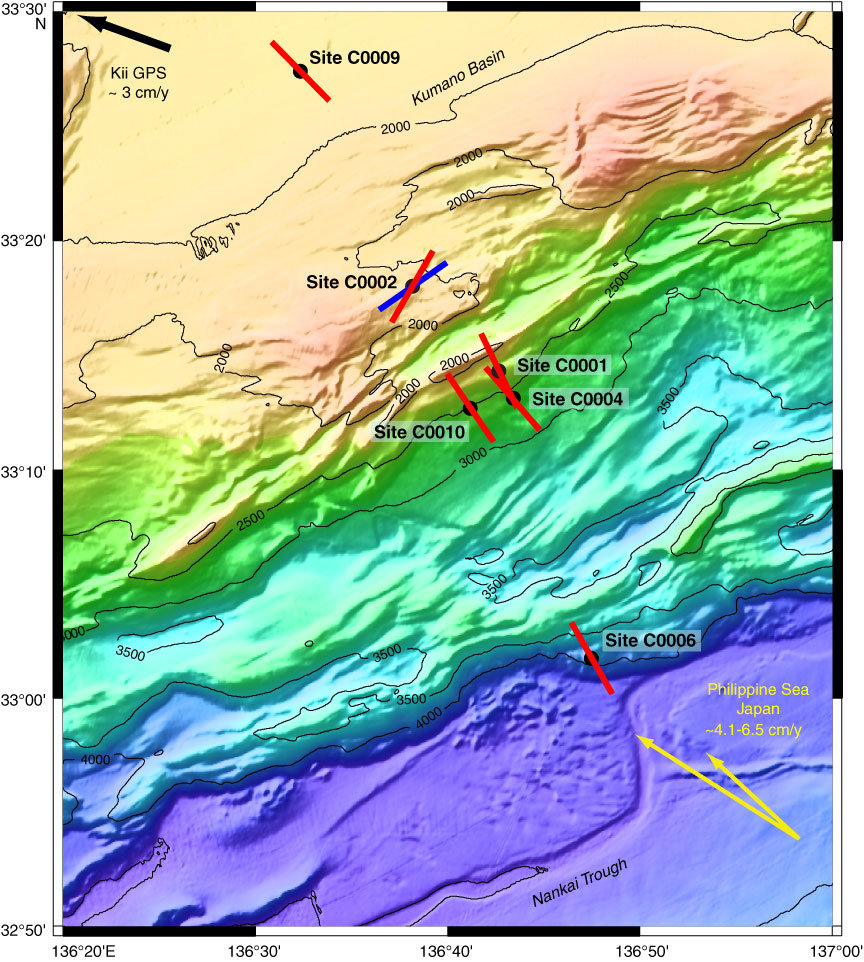
Figure F7. Map showing orientations of maximum horizontal stress (SHmax) inferred from borehole breakouts (see also Kinoshita et al., 2008). At Site C0002, red line = orientation in forearc basin sediments, blue line = orientation in underlying accretionary prism. GPS = Global Positioning System.
Previous | Close | Next | Top of page